Location: Cottonwood Campground - Big Bend National Park, Texas
Total miles traveled: 3049
I left Jon's apartment around 8 this morning as the goad was to get to Big Bend National Park before dark. In case you don't know where Big Bend is...find El Paso at the western tip of Texas...then head south along the border with Mexico, and where the border makes a "U" shape is the park - hence "Big Bend."
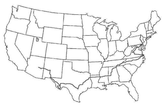
The best way to get there was to head south towards San Antonio, and then catch I10 West all the way to Fort Stockton, which would be quite a haul, and the follow a highway into the park 150 miles south. It would be a full day of driving altogether.
I finally arrived in Fort Stockton around 3pm (or 4...I keep forgetting to change the time on my car radio). I begin to head south towards the park, but I saw heavy storm clouds ahead along with some lightning, so I began to get discouraged. And I was still about 100 miles away. I decided I didn't want to get there, near sunset, in the rain, so I chose to head North and try to get to the Guadalupe Mountains (on the TX/NM border).
I got a little antsy and began to drive too fast on the two-lane highway that would eventually take me back North. On this highway, there were no posted speed limits, and rarely would you pass any cars. My foolishness caught up with me and I was noticed by a patrolman who subsequently pulled me over. As odd as this may sound, if it were not for me being pulled over, my day wouldn't have turned out nearly as great as it did.
Officer Graham did the usual...asked for the license and insurance and he brought it back to his jeep, after asking me a few questions. He tooks a while, so I sat there, mad at myself, assuming he was writing up a ticket. However, he came back with just my paperwork in hand. What he said next was pretty smart and I'll never forget it:
Officer Graham: "Mr. Curtin, are you in college?"
Me: "Just recently graduated, Sir."
Officer Graham: "What was your major?"
Me: "Management."
Officer Graham: "See if you can manage to go a little slower."
I didn't laugh right then, but I thought that was so very clever. He was extremely friendly and courteous, and he asked about my plans. I told him of my decision to skip Big Bend, but he said it's something that shouldn't be missed, and he didn't think the weater was bad there. He actually volunteered to use his radio to find out the conditions at the Park...he got back to me and said it should be pretty clear down there, so it would be worthwhile to take the drive. Another route into the park would be coming up shortly at the next town, and he recommended I use that highway.
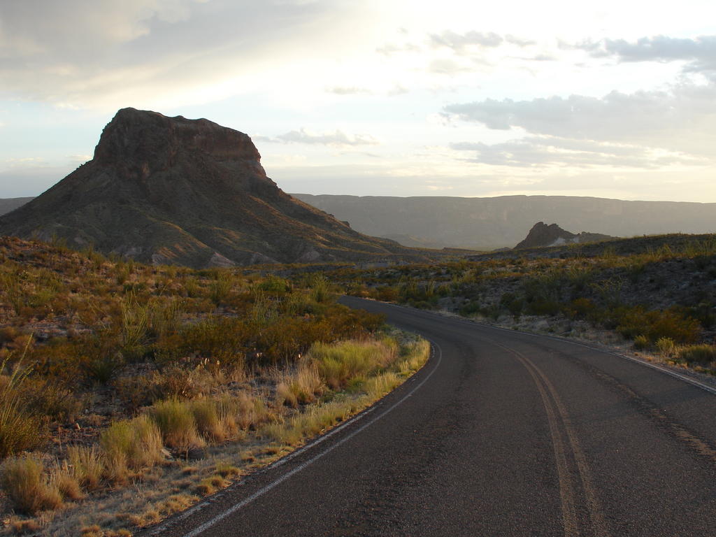
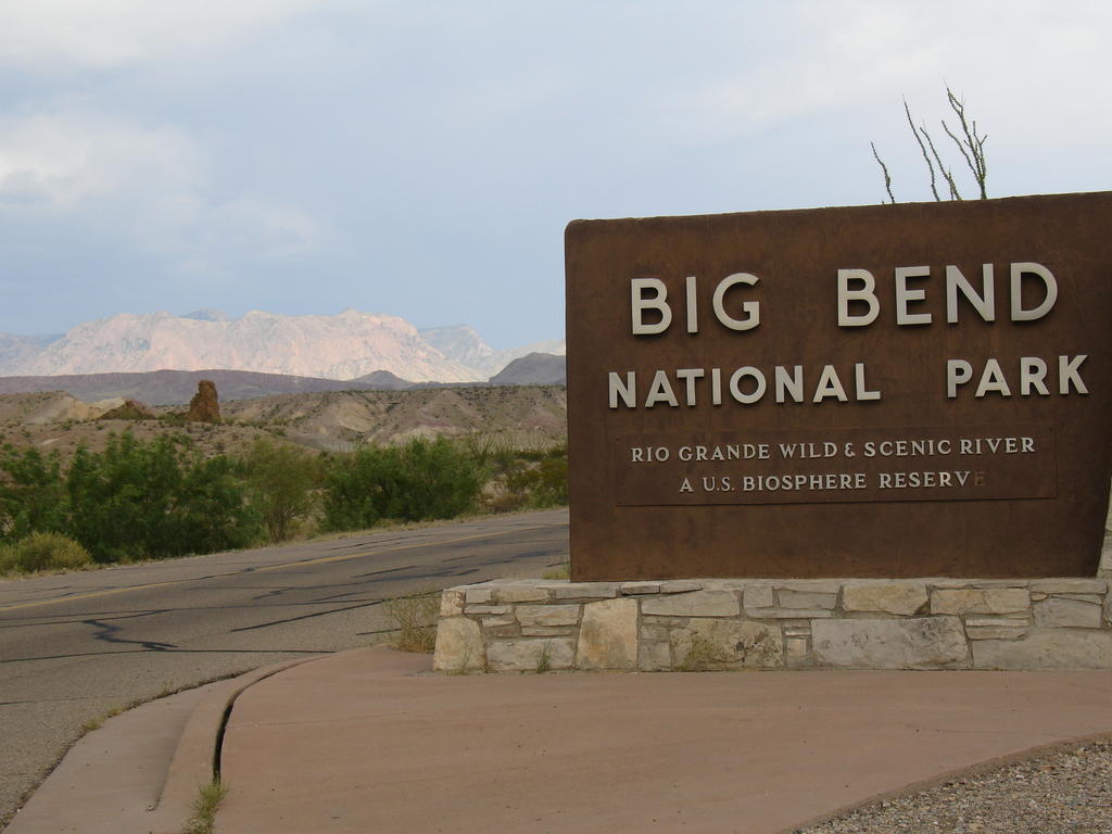
I arrived in the next town, Alpine, got some gas, and headed South towards the park. It was an incredible drive...hills and mountains along a winding road...it took me a while to actually get to the park because I kept pulling over to take pictures. Spectacular views were hidden just around corners, and you'd have no idea what would be coming up around these turns. It was gorgeous, but nothing compared to when I actually arrived at Big Bend.

Pictures don't do this place justice - I have never seen anything like this, and I was awe struck, fortunate enough to see this place at sunset, with just a few clouds in the sky. Hopefully the pictures give you some idea of the beauty and size of this place, but you'd really have to be here to understand, I think. I actually wish I could post more than a few - I took near 140 pictures from the entrance of the park to only 15 miles in.
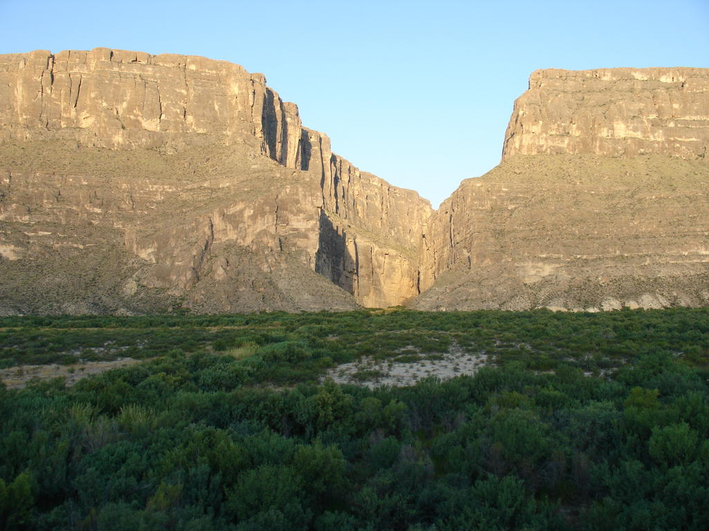
As I mentioned, Big Bend is an enormous park, with a couple roads running through it. I followed a major route towards the Santa Elena canyon while the sun was going down. Before the canyon, I noticed a sign for a public campground. I decided I'd better pitch tent for the night before it gets dark, and then I'd have the morning to do a little hiking.
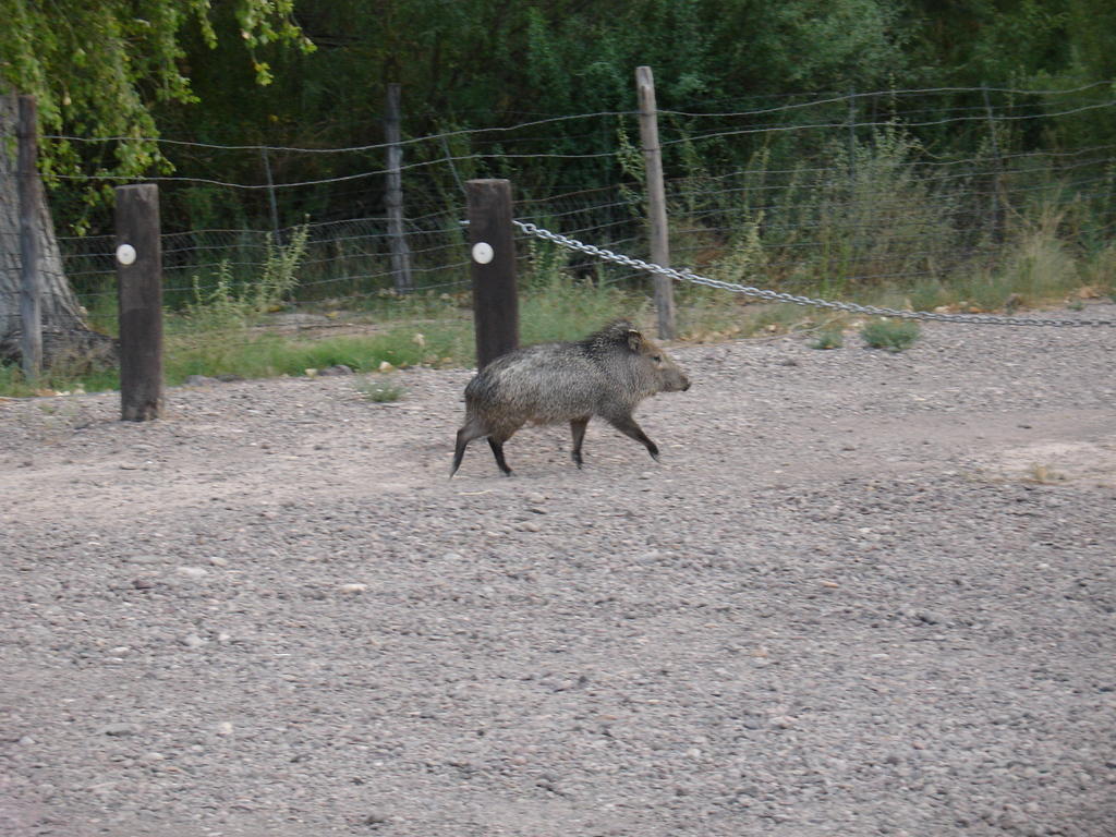
Near the campground I saw some javelinas which I had read about in my guide book. Javelinas are pig-like animals that are common in this region. There are a lot of signs warning visitors to leave food locked in their cars, as javelinas have been known to tear down tents when they get hungry and smell something. No worries here, my granola bars and Honey Combs are stowed safely in my backseat.

The campground here is run on an honor code - every night you stay costs $10 - you leave your check or cash in an envelope and drop it off in a secure box. I definitely couldn't argue with that price, especially since the quality of this campground was far above and beyond that of River Valley in NC. Oddly enough, I was the only one in the entire campground.
It was great having the whole place to myself. I got the tent set up while it was still light out (not that it takes a lot of time, anyway) and was able to watch the moon and Venus set, and the stars come out. There's no artificial light here (other than from my flashlight), so I've never seen as many stars. The campground is near the canyon wall, as well...all in all, a pretty nice place to spend the night.
So as you can see, if I never got pulled over I never would have seen this great place. Odd how things work like that.
Joe

 I got out and walked the Chimneys trail which I had passed last night. It was only a 3 mile hike, but I was glad I brought a lot of water. In this dry heat, you don't notice sweating so much, so you have to keep drinking water or you can dehydrate quickly. On the hike I saw all types of cacti and some lizards scurrying about. Speaking of animals, since yesterday I've seen a number of jackrabbits and roadrunners...roadrunners are nothing like the cartoon, but they move pretty quickly across the ground.
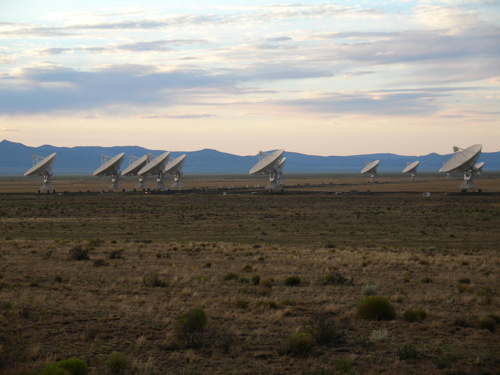 I was always impressed by the size of this place, but I had no idea how big it was until I saw it for myself. The individual telescopes are set on little railroad tracks in a "Y" shape, so they can be moved around into different positions easily. If the radio astronomers need to focus on a specific area in space, they spread the dishes out wider. If they need a broader focus, than they move the dishes closer together.
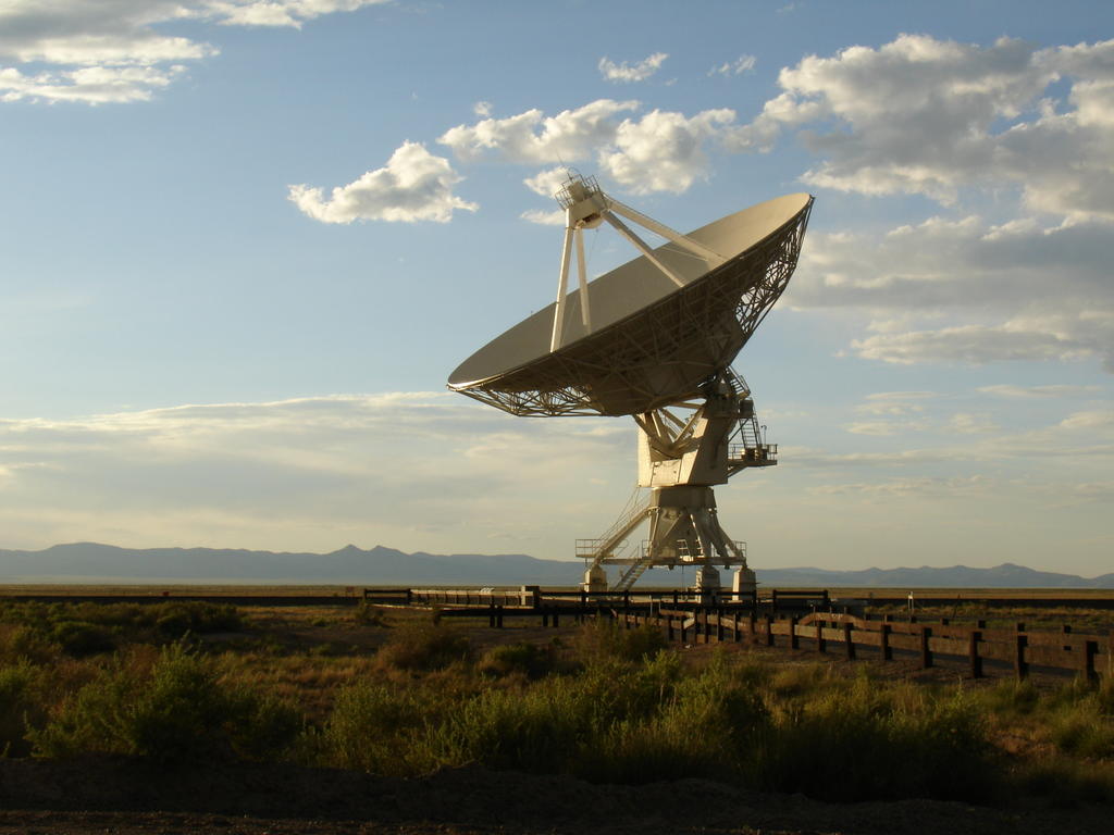
 Location: Cottonwood Campground - Big Bend National Park, Texas